Factors Causing Regional Temperature Difference Under Radiation Cooling
19 January 2026
CHONG Sze-ning
Since the operations of the Cold Weather Warning System in 1999, 2025 marked the first year with no Cold Weather Warning issued in November and December. It was not until the beginning of the 2026 that cold weather started affect Hong Kong in this winter. Replenishment of the winter monsoon arrived in the second week of January, bringing an extended period of cold weather to southern China. Although Hong Kong was affected by winter monsoon in those few days, detailed analysis showed that the cold weather conditions in those few days were different from each other. For instance, on the day after the Cold Weather Warning was issued (6 January), temperatures over the territory generally fell below 12°C, with a relatively small variations in the minimum temperatures recorded in urban areas and the New Territories (Figure 1). Although the temperature in the urban areas rose slightly on 10 January morning, the minimum temperature generally fell below 10°C for most parts of the New Territories. The temperature difference between urban and some areas over the New Territories was rather large that morning. For example, the difference in minimum temperature between the Hong Kong Observatory and Ta Kwu Ling reached 10.7 degrees, which was rarely observed. What was the reason behind?
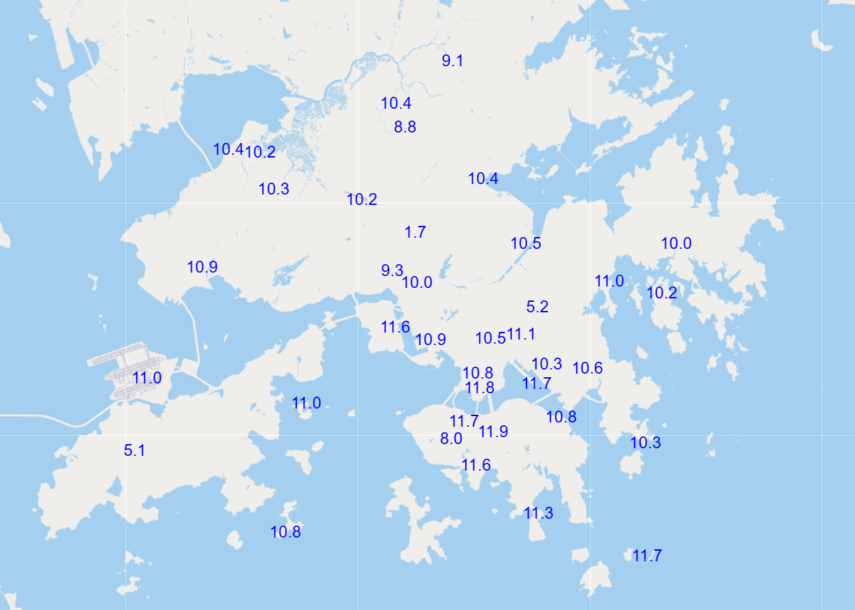
Figure 1: Minimum temperature distribution across various stations on 6 January (in degrees Celsius). The difference between urban areas and the New Territories was relatively small.
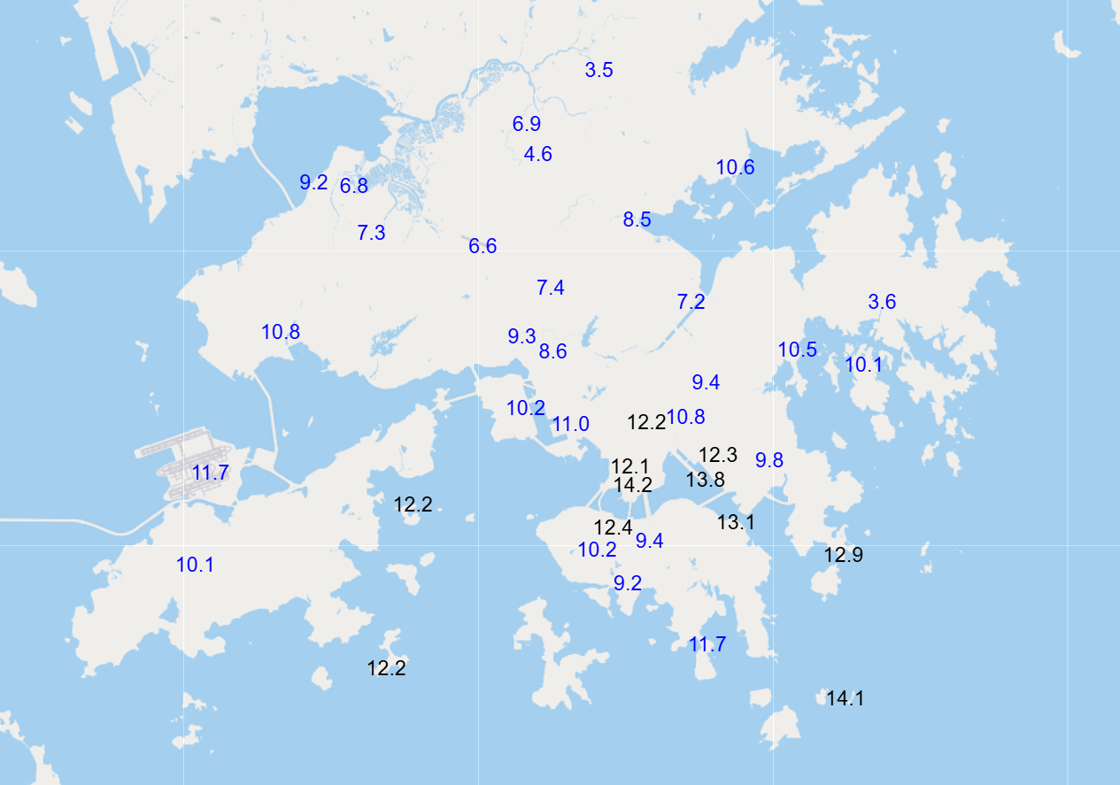
Figure 2: Minimum temperature distribution across various stations on 10 January (in degrees Celsius), showing a difference of over ten degrees between urban and some areas in the New Territories.
Under clear skies, with light winds and dry condition, the radiation cooling effect is more prominent in open inland areas of the New Territories, leading to a sharper nighttime temperature drop than urban areas. On comparing the weather conditions during night-time of 5 January and 9 January, the low level atmosphere in the latter was noticeably drier with weaker winds (Figure 3) although clear sky condition occurred at both nights. This resulted in a rather strong radiation cooling effect explaining the considerable regional temperature difference on 10 January morning.
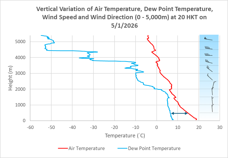
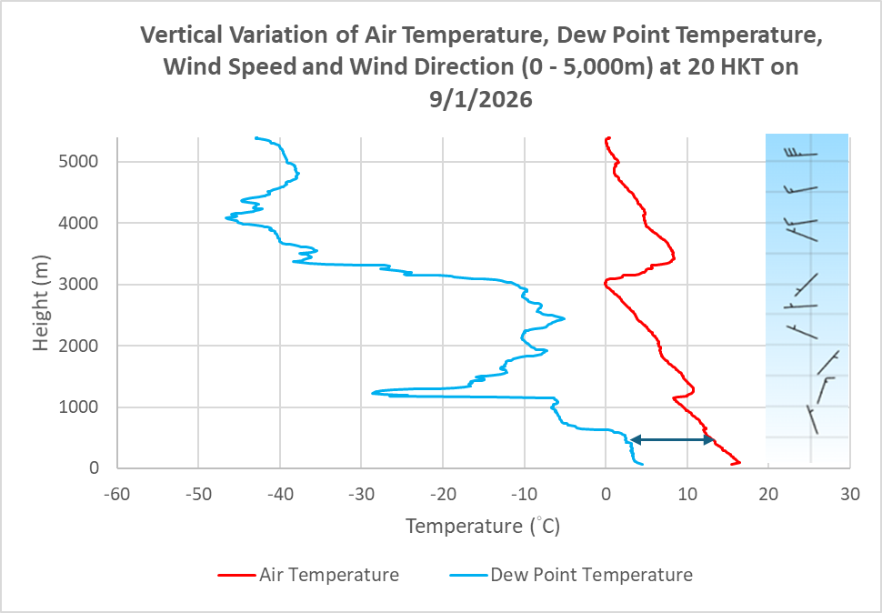
Figure 3: A comparison of lower atmospheric conditions at 8 p.m. on 5 January (top) and 9 January (bottom). The difference between air temperature and dew point temperature (dew point depression) in the latter was larger, which shows that the low level atmosphere was noticeably drier.
While the conclusion of whether radiation cooling effect is favorable could be reached through analysing the meteorological conditions, the extent of temperature drop in various regions depends on factors such as topography, cold-air pooling, daytime heating, change in wind strength overnight, etc. On reviewing the overnight period of 7 to 8 January, it was observed that the temperature fluctuations and the wind speed at the Ta Kwu Ling weather station had certain correlation with each other. When the wind speed increased slightly, the temperature also rose accordingly (Figure 4). In contrast, during the nearly windless overnight period of 9 to 10 January, the overall decreasing trend of temperature was more stable although there were still small fluctuations (Figure 5). Such variations in wind speed over localized area bring uncertainties in the forecast of minimum temperature.
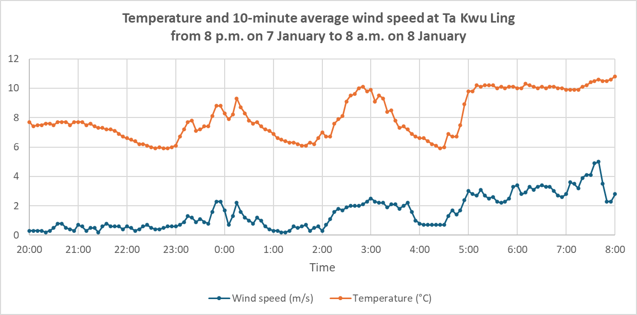
Figure 4: Temperature and 10-minute average wind speed at Ta Kwu Ling from 8 p.m. on 7 January to 8 a.m. on 8 January.
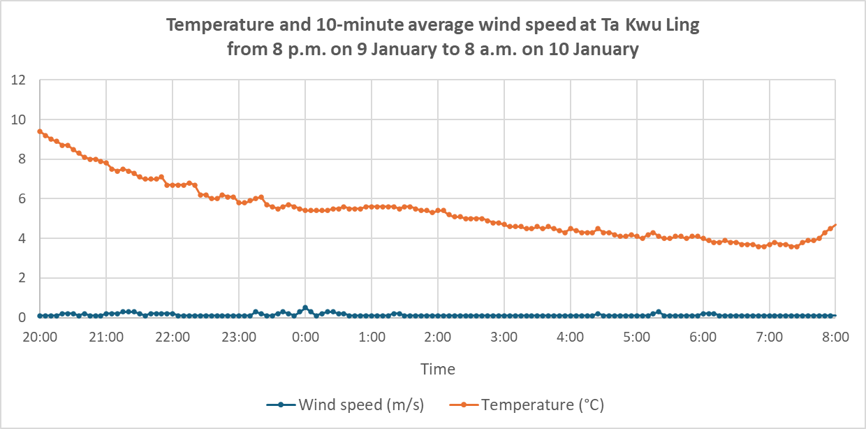
Figure 5: Temperature and 10-minute average wind speed at Ta Kwu Ling from 8 p.m. on 9 January to 8 a.m. on 10 January.
Whenever Hong Kong is expected to be generally affected by cold weather, the Observatory will issue the Cold Weather Warning to alert members of the public of the danger of low body temperature in cold weather. If the regional temperature differences are significant, descriptions such as “relatively/rather large temperature difference between day and night” or “temperatures significantly lower in the New Territories” will be included in the weather forecast bulletins. Should there be suitable weather conditions, frost may form. When the Observatory expects ground frost to occur on high ground or in the New Territories, Frost Warning will be issued to alert farmers and others concerned to take necessary precautionary measures against frost damage to vegetation.