M7.4 Northern Molucca sea, Indonesia Major Earthquake on 2 April 2026
2 April 2026
Wilson WS Chan, David TW Hui
According to the analysis by the Hong Kong Observatory, a major earthquake occurred in northern Molucca Sea at 6:48 a.m. Hong Kong Time on 2 April 2026. The final revision of the earthquake magnitude was M7.4. It was a shallow earthquake with a focal depth of around 10 km. The epicentre was located approximately 160 kilometres east of Manado, about 2,680 km southeast of Hong Kong. This distant earthquake was not felt in Hong Kong. However, the seismograph station at Po Shan, Hong Kong did clearly detect the P-wave of this event at around 22:53UTC, 1 April 2026 (6:53am, 2 April 2026 Hong Kong Time), approximately 5 minutes after the origin time. (HKT = UTC + 8 hours)
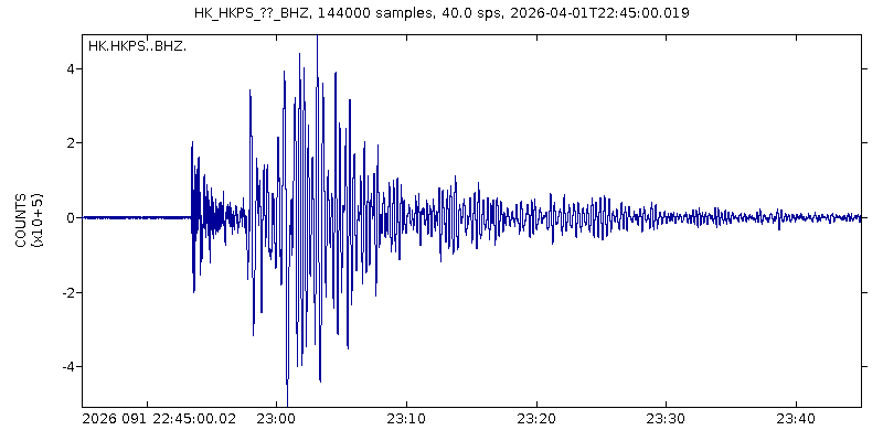
Figure 1 The seismic waves associated with the major earthquake with magnitude 7.4 in Northern Molucca Sea, Indonesia recorded at Po Shan station, Hong Kong on 2 April 2026.
The tsunami triggered by the major earthquake in the northern Molucca Sea, Indonesia, was recorded during the day on 2 April 2026. Tsunami waves of approximately 0.65 metres, 0.15 metres, and 0.13 metres high were respectively observed at Port of Kema Fishing, Port of Beo, and Talengen Tourism Pier in North Sulawesi, Indonesia, while Davao in the Philippines recorded a tsunami wave height of 0.05 metres (5 cm). According to the calculation of the Hong Kong Observatory’s tsunami model (Figure 2), as the tsunami waves spreading out, the tsunami waves were largely obstructed by the surrounding islands within Molucca Sea and Sulawesi Sea, and the tsunami energy was weakened by a large extent. The tsunami heights away from the region were significantly lower. No tsunami waves were detected in southern China including Hong Kong.
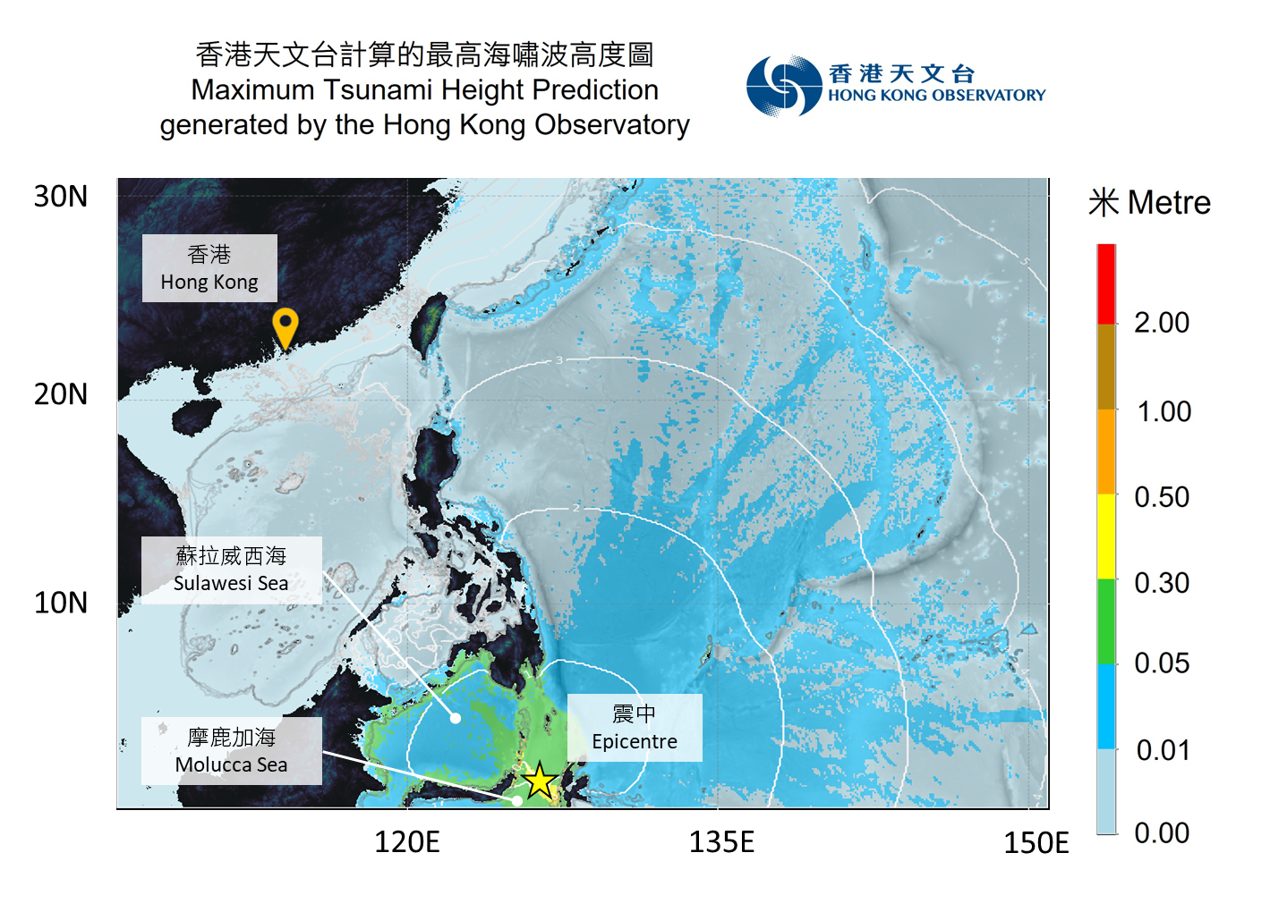
Figure 2 Tsunami wave heights (shown in colour) and travel times (white lines at hourly intervals) calculated by the Hong Kong Observatory.
The Molucca Sea in Indonesia is located at the complex junction of the Sunda Plate, the Philippine Plate and the Indo-Australian Plate (Figure 3). It is an integral part of the Pacific Ring of Fire, where seismic activity is frequent. From 1900 to 2 April 2026, a total of 52 earthquakes with a magnitude of 7.0 or above have occurred within 500 km of the epicentre, the most recent being a magnitude 7.0 event on 21 January 2021 [1]. The major earthquake this time was a reverse faulting event (Figure 4) occurring at a shallow depth (a focal depth of about 10 km). This released elastic energy from the crust, triggering a tsunami that posed a threat to nearby coastal areas.
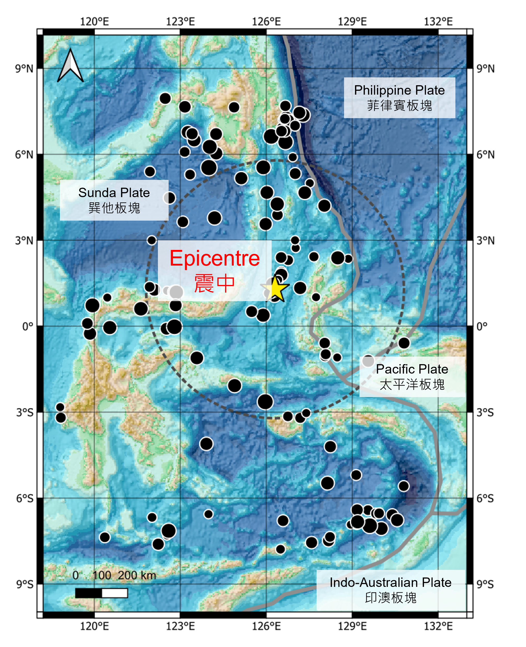
Figure 3: A map showing the tectonic plates and the location of this earthquake and the historical earthquakes in the region.
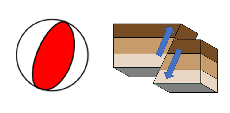
Figure 4: Focal mechanism of this earthquake (left) and the corresponding fault motion (right)
The Hong Kong Observatory continuously monitor the water level data from tide stations and tsunami buoys across the western Pacific and the South China Sea. Based on the sea level observations from the UNESCO Intergovernmental Oceanographic Commission’s webpage for Sea Level Station Monitoring Facility, a maximum tsunami wave height of around 0.65 metres was found in the sea level records of the Port of Kema Fishing in North Sulawesi, Indonesia on the morning of 2 April 2026 in Hong Kong Time (Figure 5).
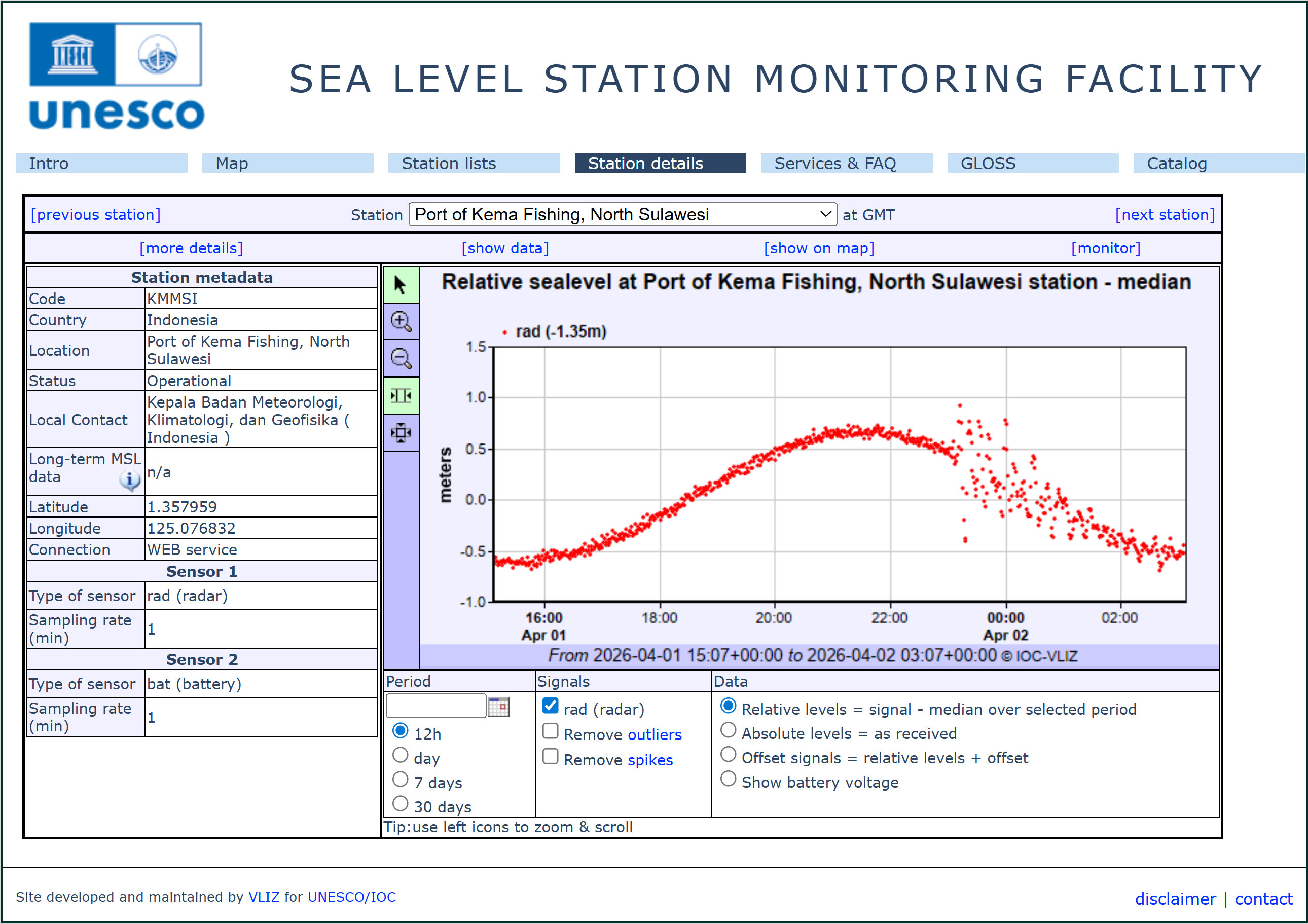
Figure 5: Water level observations at Port of Kema Fishing, North Sulawesi, Indonesia, as shown on the UNESCO Intergovernmental Oceanographic Commission’s webpage for Sea Level Station Monitoring Facility[2].
References:
[1] United States Geological Survey (USGS): Earthquake Catalog
[2] The Intergovernmental Oceanographic Commission of UNESCO (UNESCO-IOC) "Sea level station monitoring facility" website