HKO website adds real-time weather photos at Tai Mo Shan overlooking northeast
29 December 2022
Following the release of real-time weather photos at Tai Mo Shan looking towards the southwest in August last year, the Observatory adds weather photos overlooking the northeast to its website today (December 29). The weather photos further enhance regional weather information, facilitating the public to better understand the latest weather conditions near Tai Mo Shan and the northeastern part of the New Territories.
Having a wide view, the newly installed camera overlooks the areas around Tai Po, Tolo Harbour and Whitehead. Distant places like Pat Sin Leng, Plover Cove Reservoir and Port Island located 20 kilometres away are also visible.
The newly installed weather camera at Tai Mo Shan looking towards the northeast complements the southwest-facing one installed last year. Through these two weather cameras, the Observatory can monitor the weather changes brought about by weather systems approaching from the north or the south.
Members of the public can see the weather photos overlooking the northeast from Tai Mo Shan on HKO's webpage "Regional Weather in Hong Kong". The new photos will soon be available in the mobile application "MyObservatory" as well.
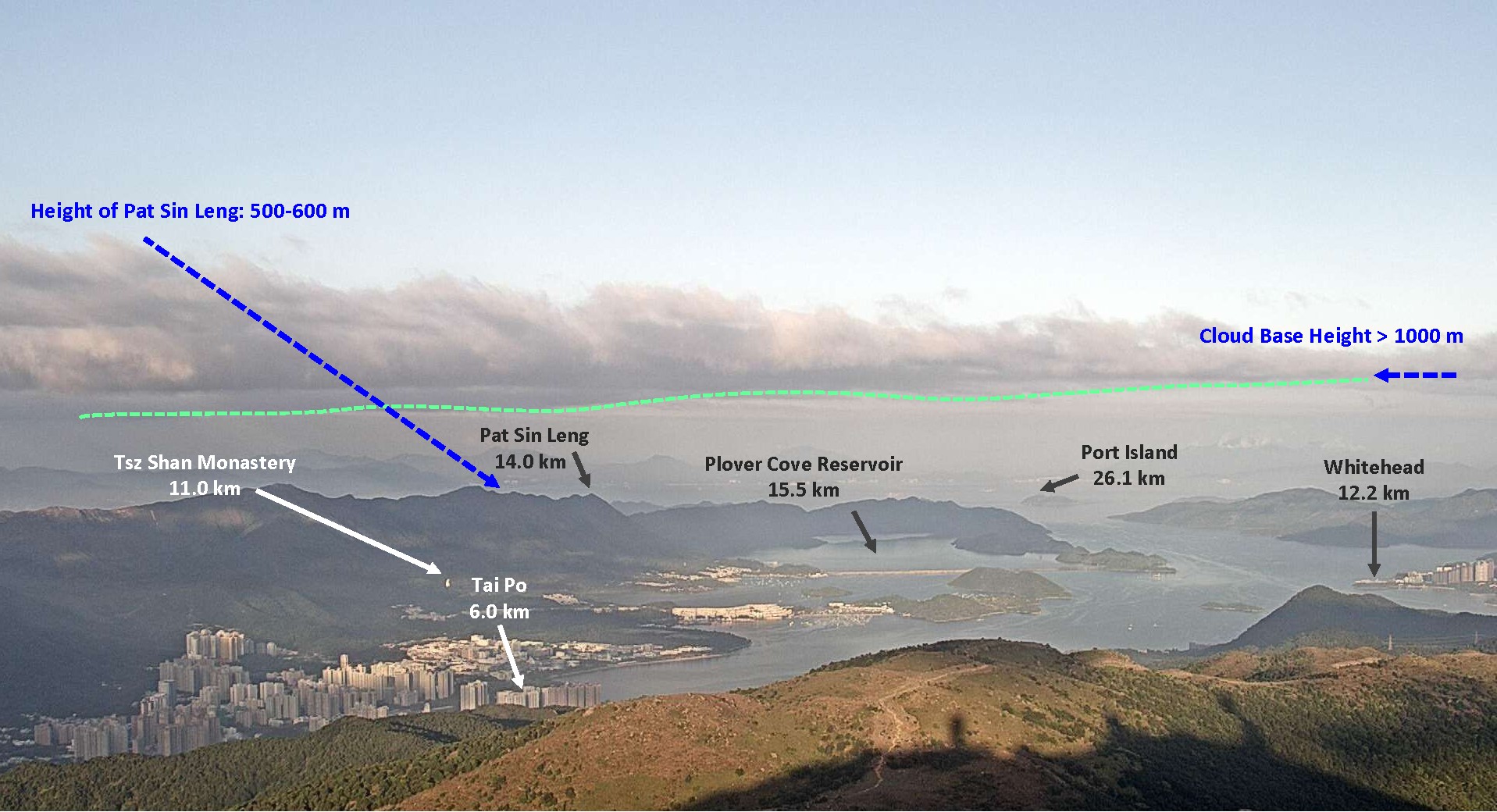
Figure 1 The view of new weather photos at Tai Mo Shan is wide (the distance between each location and the camera is shown in unit of kilometre. The weather photo was taken at around 5 p.m. on 17 November 2022). It depicted a layer of clouds extending over 10 kilometers wide. Estimated from the height of Pat Sin Leng, the height of cloud base in the photo was above 1000 metres, which generally matched the height of possible clouds as suggested in the upper-air weather data that night (Figure 2).
Figure 2 As shown in the upper-air weather data at the night of 17 November 2022, the air and dew point temperatures at around 1000 m height were very close to each other, suggesting the possible presence of clouds. This height generally matched the cloud base height over Pat Sin Leng observed at around 5 p.m. in Figure 1.