Radar pictures overlaid with lightning locations
|
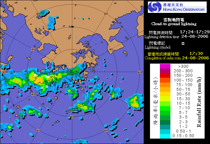
Since its launch in June last year, the lightning location information service on AMIDS was well received by the aviation community. To help users avoid severe weather, a new AMIDS product showing rain areas detected by the radar overlaid with lightning locations was released on 6 July 2006. From the distribution of lightning bearing rain areas, the aviation community will be better able to gain a comprehensive appreciation of the severe weather location. |
|