Satellite Images and Tropical Cyclone Track with Flight Routes
|
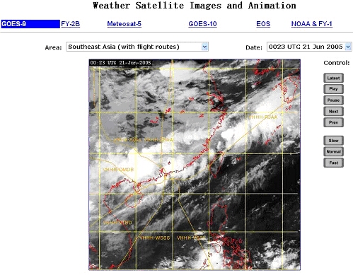
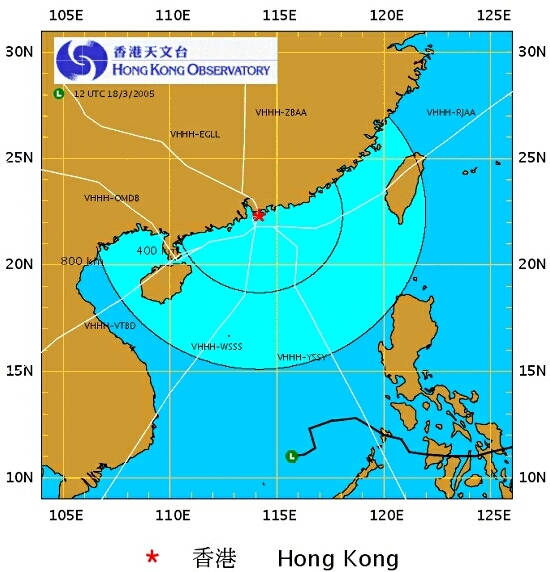
To facilitate airline users to appreciate the weather situation along the flight routes, satellite images and tropical cyclone tracks overlaid with flight routes specified by airline users have been added on the AMIDS. |
An example of satellite image with flight routes on the AMIDS
An example of the HKO tropical cyclone track with flight routes |