Super Typhoon Ragasa (2518) > Figure 4b
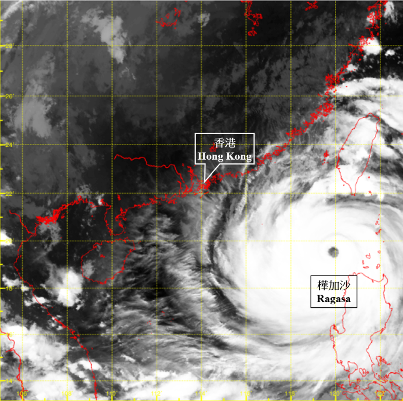
Figure 4b Infra-red satellite imagery at around 10:30 p.m. on 22 September 2025. As Ragasa’s centre did not pass over major landmasses such as Luzon or Taiwan, its structure remained intact with a fairly broad circulation and a clear, well‑defined eye as it entered the South China Sea. The maximum sustained wind near its centre remained at 230 km/h.
[The satellite imagery was originally captured by Himawari-9 Satellite (H-9) of Japan Meteorological Agency.]
[The satellite imagery was originally captured by Himawari-9 Satellite (H-9) of Japan Meteorological Agency.]