Super Typhoon Ragasa (2518) > Figure 4c
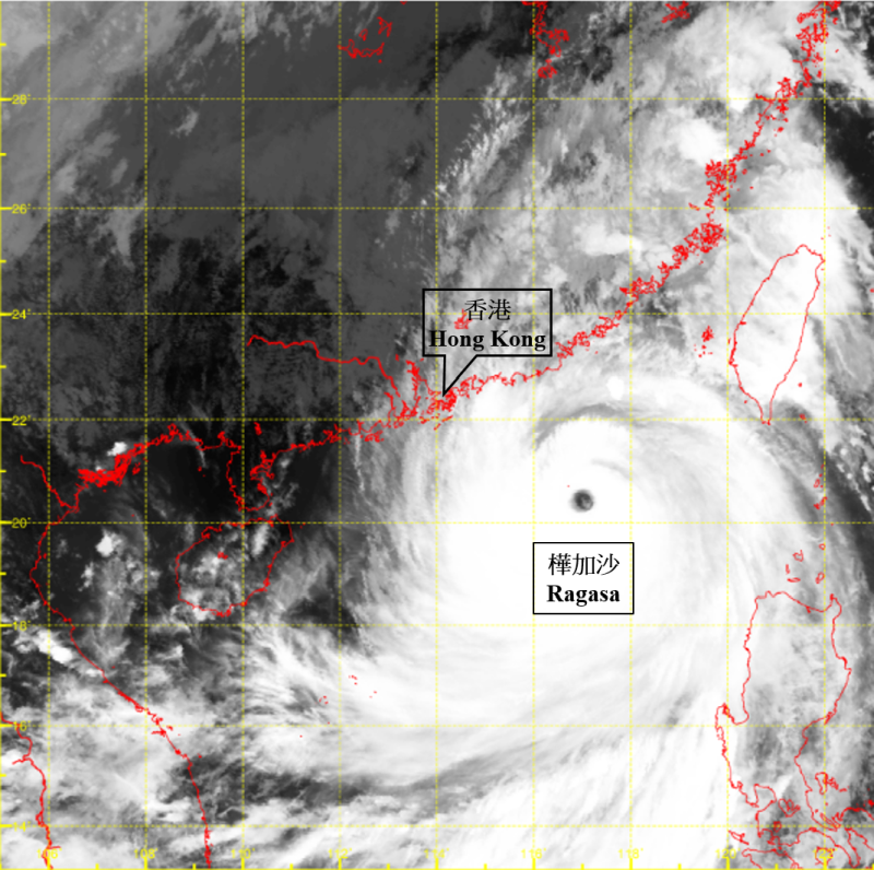
Figure 4c Infra-red satellite imagery at around 2:20 p.m. on 23 September 2025. The No. 8 Northwest Gale or Storm Signal was in force and the maximum sustained wind near the centre of Ragasa was estimated to be 210 km/h at that time. The extensive circulation of Ragasa covered the northeastern part of the South China Sea and the coast of Guangdong.
[The satellite imagery was originally captured by Himawari-9 Satellite (H-9) of Japan Meteorological Agency.]
[The satellite imagery was originally captured by Himawari-9 Satellite (H-9) of Japan Meteorological Agency.]