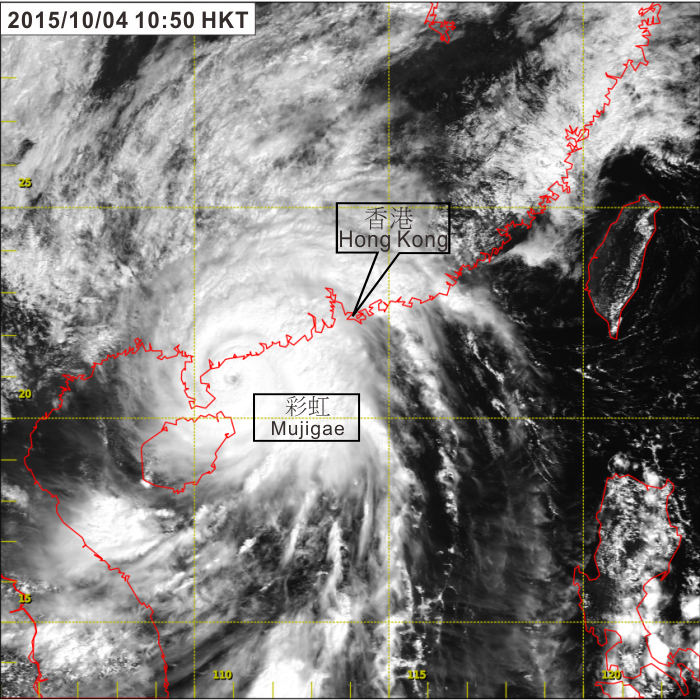
Figure 3.3.3 Visible satellite imagery around 10:50 a.m. on 4 October 2015 when Mujigae was at its peak intensity with estimated maximum sustained winds of 175 km/h near its centre. The eye of Mujigae was clearly discernible on the satellite image.
[The satellite imagery was originally captured by Himawari-8 (H-8) of Japan Meteorological Agency (JMA).]