“Satellite Imagery of Interest”: Human Footprint
15 January 2018
A new Satellite Imagery of Interest is now available on the Observatory's website. The satellite imagery shows how human activities can affect the Earth’s landscape
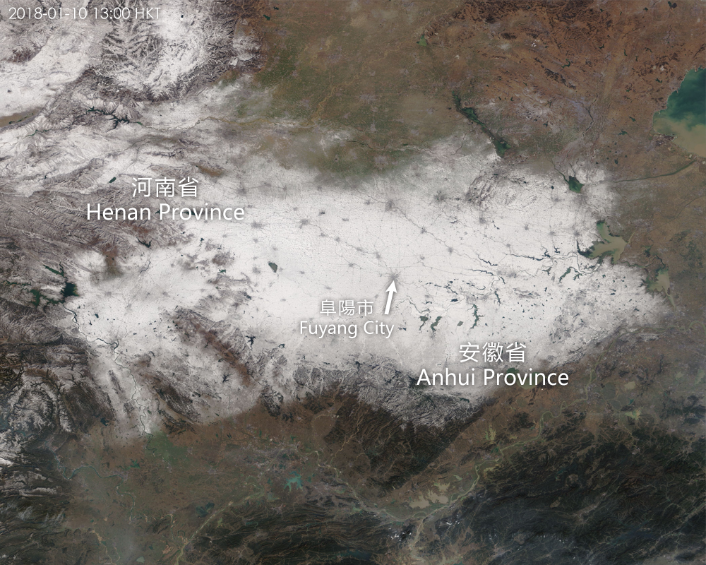
Satellite imagery can be used not only for observing clouds but sometimes also for tracing human footprint on the Earth’s landscape. On 10 January 2018, cold air affected Central China and widespread snow was observed covering vast areas of Henan and Anhui provinces. Satellite imagery on that day showed scattered greyish spots which were indeed densely populated cities. Those thin lines connecting the spots were transport networks. (The satellite image was captured by MODerate Resolution Imaging Spectroradiometer (MODIS) of NASA)
You are welcome to visit the Observatory's Weather Satellite Imagery webpage for details.
http://www.weather.gov.hk/wxinfo/intersat/satellite/sate.htm