The Observatory recently launched the "Interactive Map of Storm Damage by Mangkhut" webpage
27 March 2019
The Observatory collected photos and videos taken by the public during the passage of Super Typhoon Manghkut through its Facebook page last year. Selected photos and videos have been put on the on a GIS-based webpage "Interactive Map of Storm Damage by Mangkhut" for research and educational use. The user could click on the image/video icons to see the damages brought by Mangkhut, including fallen trees, flooding, damaged buildings and others. The webpage shows that Mangkhut brought widespread damages to Hong Kong. It intends to raise the public's awareness of getting prepared for the damaging effects of the tropical cyclones.
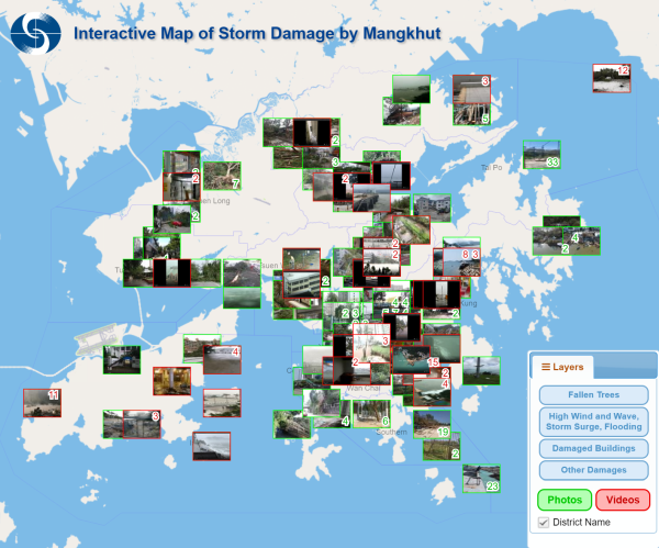
Layout of the “Interactive Map of Storm Damages by Mangkhut” webpage