Tropical Cyclone
|
Tropical Cyclone | |
|
16 July 2004 | |
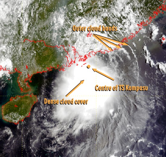 |
Kompasu was the only tropical cyclone in 2004 necessitating the issuance of No. 8 Gale or Storm Signal in Hong Kong. The high-resolution image captured on 16 July 2004 shows vividly the appearance of Kompasu, including the dense cloud cover near its centre and the outer cloud bands. |
|
Image time - 10:55 a.m., 16 July 2004 The true colour image was captured by EOS TERRA satellite. This was generated by combining the satellite data from channels 1, 3 and 4. The image likens the view as seen by naked eyes from space. To know more about weather satellites, please refer to the Notes. | |
|
Tropical Cyclone | |
|
28 December 2002 and 16 April 2003 | |
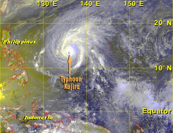 Figure 1 Typhoon Kujira in the Northern Hemisphere Image time - 1:32 p.m., 16 April 2003 |
The satellite image on the top shows a typhoon (with a distinct eye at the centre) over the northern hemisphere. The image below shows another over the southern hemisphere. Note the difference in the sense of rotation: counter-clockwise in the northern hemisphere, and clockwise in the southern hemisphere. This is a result of the Coriolis force, which is associated with the rotation of the Earth. The force deflects winds to the right in the northern hemisphere and to the left in the southern hemisphere. |
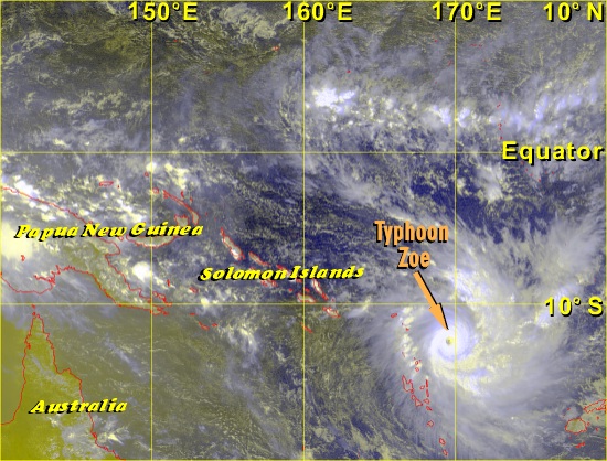 Figure 2 Typhoon Zoe in the Southern Hemisphere Image time - 10:32 a.m., 28 December 2002 | |
|
The satellite image, which was captured by GMS-5, was specially processed using VIS and IR1 channels, with assignment of colours to bring out features of special interest. To know more about weather satellites, please refer to the Notes. | |
|
Tropical Cyclone | |
|
31 August 2002 | |
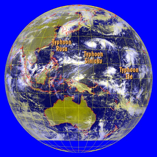 |
Satellite picture showing Typhoon Rusa near the Korean Peninsula and Typhoons Sinlaku and Ele further east over the western North Pacific. All of them packed winds exceeding 118 km/h (64 knots). The tendency for tropical cyclones to develop further to the east of the western North Pacific, and subsequently track over that part of the ocean, resembles the behaviour of tropical cyclones in typical El Nino years. |
|
Image time - 10:32 a.m., 31 August 2002 The satellite image, which was captured by GMS-5, was specially processed using VIS and IR1 channels, with assignment of colours to bring out features of special interest. To know more about weather satellites, please refer to the Notes. | |
|
Tropical Cyclone | |
|
16 October 2001 | |
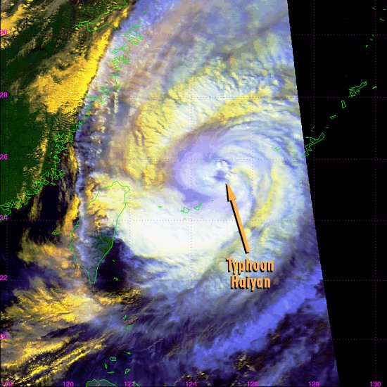 |
The satellite image shows clearly the eye of Typhoon Haiyan as well as its outer circulation and cloud bands. At the time the image was taken, Haiyan reached its peak wind strength of 140 km/h near its centre and was tracking northeastward. Polar-orbiting weather satellites are capable of observing features down to 1 km. This enables good depiction of the structure of tropical cyclones and estimation of their location and strength. |
|
Image time - 2:13 p.m., 16 October 2001 The satellite image, which was captured by NOAA-16, was specially processed using channels 1, 2 and 4, with assignment of colours to bring out features of special interest. Major features appearing on the image include deep clouds (white), low clouds (pale yellow), high clouds (blue) and vegetation (green). To know more about weather satellites, please refer to the Notes. | |