Super Typhoon Yagi Ushers in Second Half of the Tropical Cyclone Season

Super Typhoon Yagi Ushers in Second Half of the Tropical Cyclone Season
Lui Yuk-sing
After the “halftime” of Hong Kong’s tropical cyclone season in August 2024, the Observatory issued the first No. 8 Gale or Storm Signal in 2024, when Super Typhoon Yagi impacted Hong Kong in September.
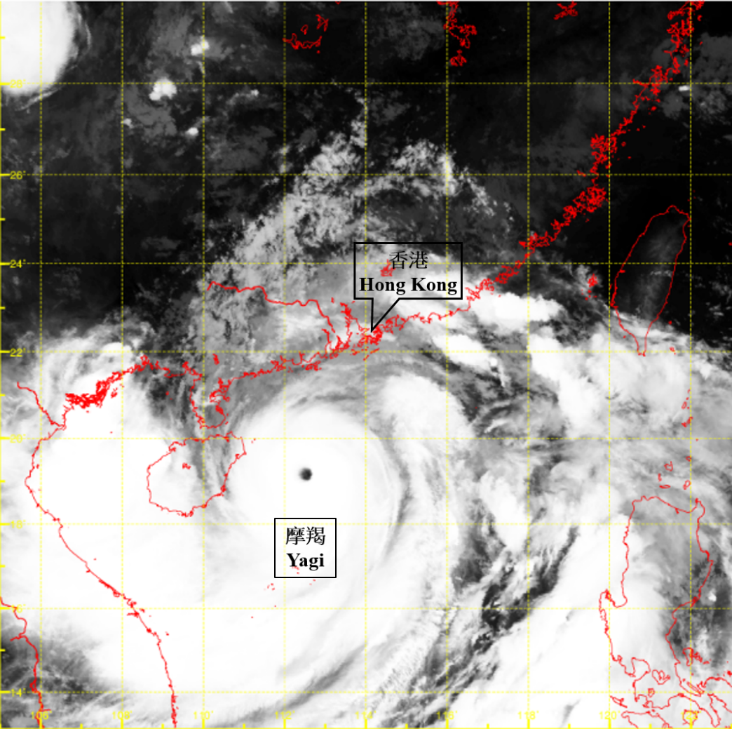
Under favourable conditions such as very warm sea surface temperatures and weak vertical wind shear, Yagi rapidly intensified from a severe tropical storm to a super typhoon in the South China Sea on 4 September, and reached its highest intensity in the early morning of 6 September. The maximum sustained wind speed near the centre was estimated to be 230 kilometres per hour, making it the second strongest tropical cyclone in the South China Sea since the Observatory began recording in 1950, tied with Super Typhoon Saola in 2023.
Infrared satellite image taken around 5:00 a.m. on 6 September 2024, when Yagi reached its peak intensity.