Sandstorms in China and visibility in Hong Kong
22 March 2010
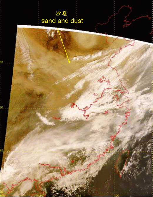
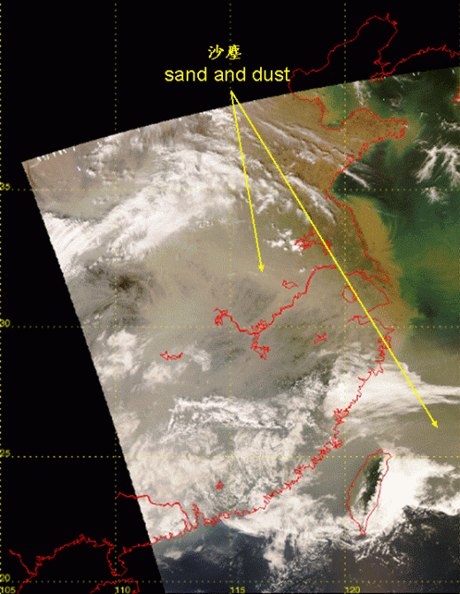
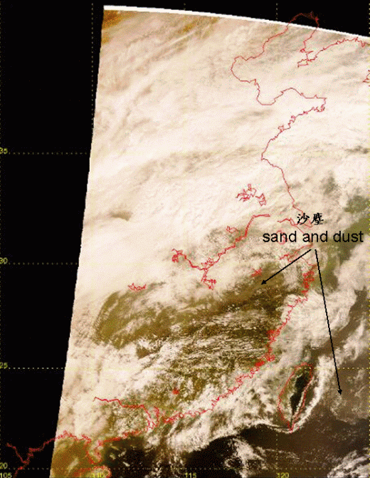
Sand and dust associated with a sandstorm spread southeast from northern China in the past few days.The whole episode was captured by the true colour images from the Earth Observing Satellite. The satellite picture suggested that sand and dust were located over northern China on March 20 (Figure 1) and reached central and eastern China on March 21 (Figure 2). They spread to Taiwan and its adjacent waters today (22 March) (Figure 3).
Hong Kong is mainly affected by easterlies today. Due to suspended particulates, the visibility over Hong Kong was rather low and dropped to below 3000m today. It is expected that winds over Hong Kong will turn to southeasterlies during the day tomorrow and will persist for a couple of days.The visibility will improve slightly in the next couple of days.

Fig. 1 True colour image from Earth Observing Satellite at 10:50 a.m., 20 March 2010. Sand and dust was affecting northern China at that time.

Fig. 2 True colour image from Earth Observing Satellite at 1:06 p.m., 21 March 2010. Sand and dust had spread to central and eastern China.

Fig. 3 True colour image from Earth Observing Satellite at 10:38 a.m., 22 March 2010.Sand and dust spread to Taiwan and its adjacent waters. As southern China was generally covered by clouds, sand and dust were not observed from the satellite picture.