Radar Image Gallery
Artifacts
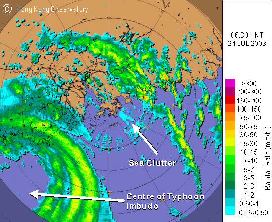 |
Typhoon Imbudo came close to the western coast of Guangdong in the morning of 24 July 2003. The radar image time corresponds to the moment when Imbudo was closest to Hong Kong (about 280 kilometres southwest of Hong Kong). The Tropical Cyclone Warning Signal No.8 was in force at the time. Relatively weak but uniform echoes were observed over the surrounding waters of Hong Kong. This kind of spurious echoes is called 'Sea Clutter' and is caused by reflection from rough seas, a result of the storm's gale force winds. Sea clutter mainly occurs close to the radar site. It appears as a stationary feature in an animation sequence. |
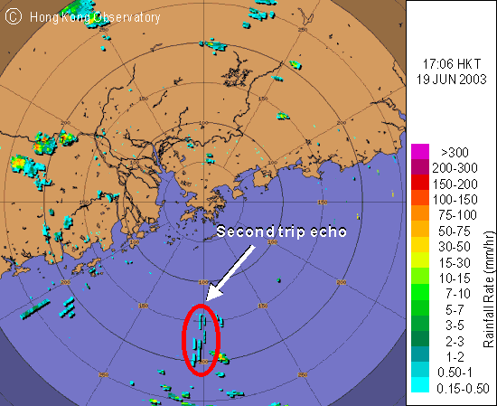 |
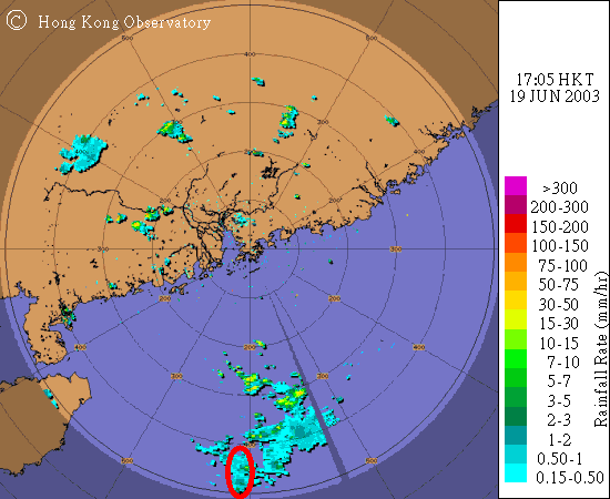
Weather radar emits microwave at fixed time intervals. Occasionally, a microwave pulse reflected from a distant rain area may arrive at the radar after the radar has emitted the next pulse of microwave. The radar thus may mistake the reflected microwave as coming from the second pulse, giving a much nearer but wrong location for the rain. Such kind of radar echo is called 'Second Trip Echo'. The radar image (upper figure) shows that second trip echoes in the form of strips were in fact caused by rain at a distance beyond 400 kilometres to our south (lower figure). |
 | |
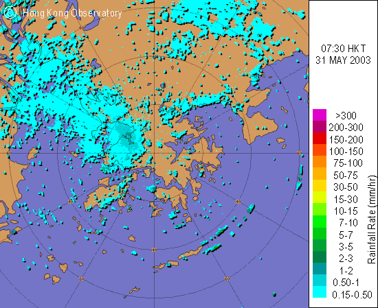 |
Users should exercise utmost care when interpreting radar images. Like the radar image on the left, under certain weather conditions (e.g. when the air is stable), the microwave from radar which would otherwise travel in a straight line might bend towards the ground. The reflected microwave would give the radar a false impression of rain. The phenomenon is called 'anomalous propagation'. The weather on that day was dry with no rainfall. |
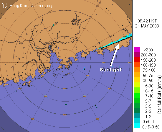 |
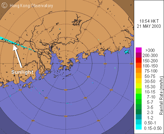
Sunlight contains microwave that matches the operating frequency of the radar. Mostly at sunrise and sunset, the radar may capture the microwave from the sun and mistake it for its own. The radar echo thus received is in the form of radial beam. The radar images captured in the early morning (upper one) and late afternoon (lower one) on the same day of 21 May 2003 depicts very well radial beams caused by sunlight in the direction of the rising sun (East) and the setting sun (West) respectively. |
 | |
