Radar Image Gallery: Historical Pictures
Historical Pictures
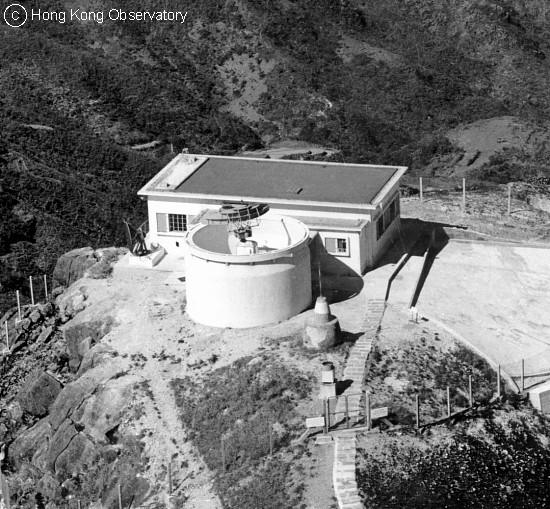 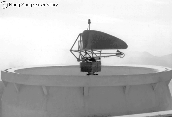 |
The Observatory's history with storm-detecting weather radar started in 1959 when a Decca 41 weather radar was first installed at Tate's Cairn, at an altitude of about 580 m above mean sea level. The lower photo shows the 4.3-m diameter double-curvature antenna of the weather radar. |
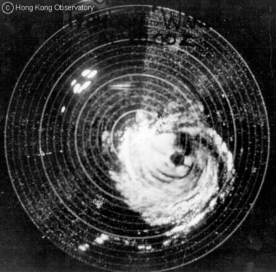 Typhoon Wanda, 1 September 1962 at 5:00 a.m. |
Typhoon Wanda was one of the most destructive typhoons in the history of Hong Kong. This image of Wanda was captured by the Observatory's first storm-detecting weather radar installed at Tate's Cairn in 1959. In the picture, clearly visible areas were the spiral rainbands (white) of Wanda. The dark hole in the centre of the rainbands was the typhoon eye. As Wanda approached Hong Kong, the Hurricane Signal No.10 was hoisted at 6:15 a.m. on 1 September 1962. The maximum gust of 259 km/h was registered at the Observatory as the storm passed that morning. This record remains unsurpassed. Damage and casualties were widespread throughout Hong Kong. 130 people were killed and 53 were missing. Approximately 72,000 people were made homeless. |
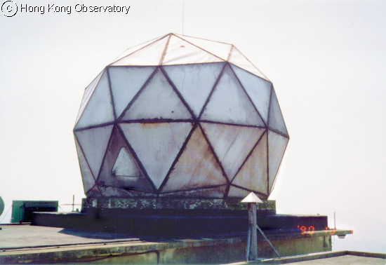 |
In 1966, the Observatory installed this more advanced weather radar at Tate's Cairn. The photo shows the radome of the radar which protects the antenna inside against strong winds and inclement weather. |
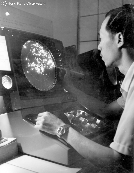 |
An Observatory personnel at work. Displayed on a monochrome cathode ray tube (CRT) display, the radar image had to viewed inside a dark room and radar echoes traced on a piece of transparent plastic for use in weather forecasting. |
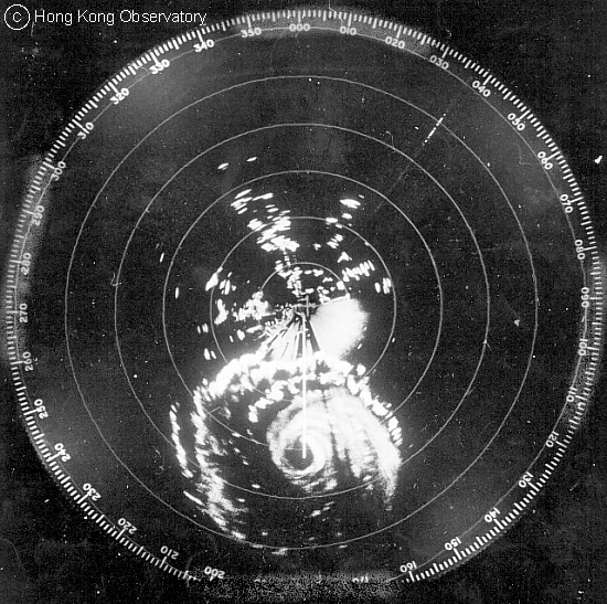 Typhoon Rose, 16 August 1971 |
Typhoon Rose was another very intense typhoon affecting Hong Kong in the 1970s. Rose's eye as well as the intense rain bands to its north were well captured by the radar. During the passage of 'Rose', there were 6 hours of gales at the Observatory, while hurricane force winds were recorded for 1 hour at the Hong Kong Airport, 2 hours at Cape Collinson and Waglan Island, 3 hours at Cheung Chau and 4 hours at Tate's Cairn. Hurricane Signal No. 10 was hoisted at 10:50 p.m. on 16 August 1971. A total of 5,644 people from 1,032 families was made homeless and 653 huts were destroyed. About 24 buildings were damaged, of which 6 were beyond repair or collapsed. |
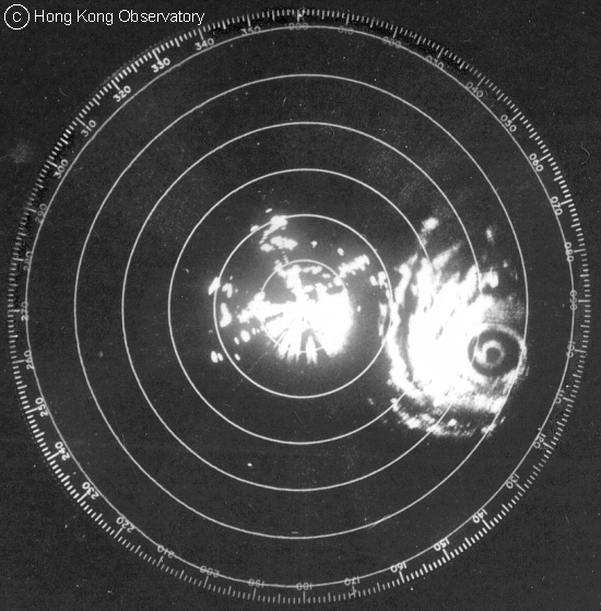 |
Double eye walls are not rare in the life cycle of a typhoon. The Observatory's radar captured vividly this feature in Typhoon Elsie in 1975 and Typhoon Hope in 1979. Both were intense storms with maximum winds exceeding 200 km/h near their centres. The Hurricane Signal No. 10 was hoisted on both occasions. |
| Typhoon Elsie, 14 October 1975 at 1:00 a.m. | |
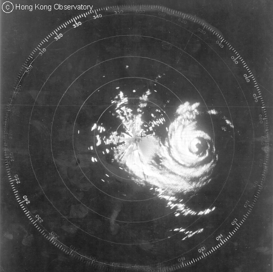 | |
| Typhoon Hope, 2 August 1979 at 8:00 a.m. | |
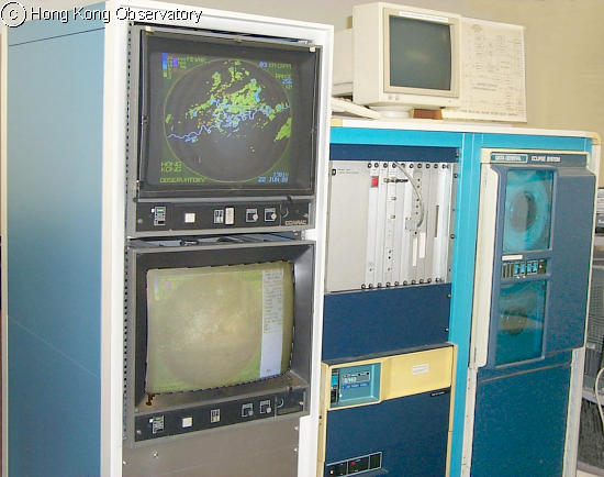 |
In 1983, the Observatory installed its first computer-based radar. The image was displayed on a colour monitor, with various colours representing different rainfall intensities. It also allowed more advanced operations such as animation and forecast of radar echo movement by simple extrapolation. Radar pictures were archived on a magnetic tape. |
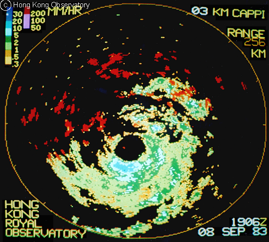 Typhoon Ellen, 9 September 1983 at 3:06 a.m. |
The computer-based radar in 1983 was installed just in time to capture Typhoon Ellen. Ellen was the only tropical cyclone necessitating the issuance of Hurricane Signal No. 10 in the 1980s. The radar picture shows a circular eye and more intense echoes in the southern half of the typhoon. At that time, Ellen came very close to the south of Hong Kong but moved slowly. This gave rise to hurricane force winds that lasted for 5 hours in Cheung Chau, with a maximum hourly mean wind of 167 km/h and gust of 237 km/h. The relatively slow movement and the persistent wind of Ellen resulted in a significant rise in the level of sea water (called 'Storm Surge') causing extensive flooding over western Kowloon. During the passage of Ellen, the Hurricane Signal No. 10 remained hoisted for 8 hours. |
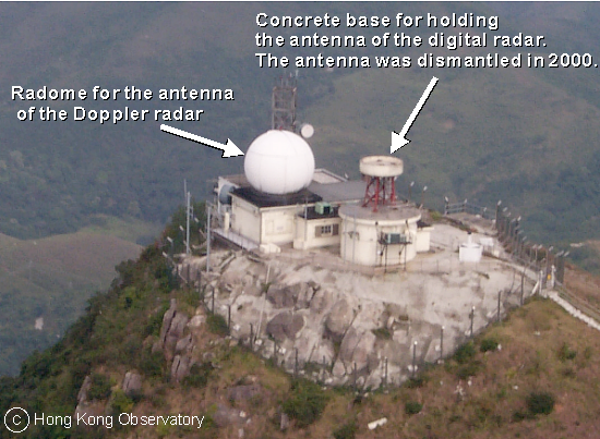 |
The Observatory implemented the first Doppler radar at Tate's Cairn in 1994. The Doppler principle can be explained by noting the change in pitch of the siren on a passing ambulance. The pitch heightens as the ambulance approaches and lowers as it departs. In addition to measuring rainfall intensity, the Doppler radar detects the speed of movement of raindrops based on the Doppler principle. |
|
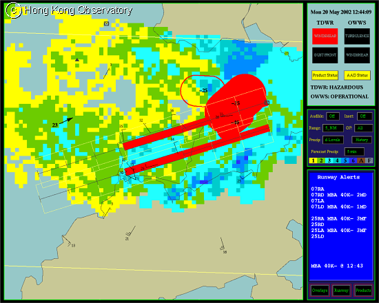
The terminal Doppler weather radar (TDWR) was implemented for the detection of windshear and microburst associated with convective storms, which might affect the safety of aircraft using the Hong Kong International Airport. The radar is strategically located at Tai Lam Chung, about 12 kilometres northeast of the airport for monitoring of convective storms affecting or likely to affect the runways. The TDWR system provides a display of windshear warnings overlaid on the radar echoes. The lower figure displays a warning (in red) of a 35-knot wind loss along the airport runways in the evening of 20 May 2002, when a tornado affected the southeastern part of the airport island. |
|
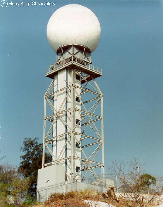
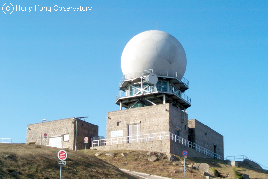
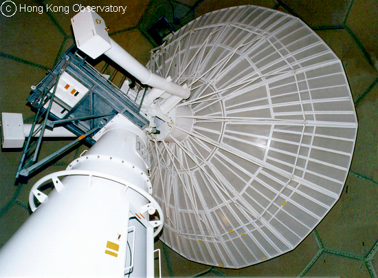
The Observatory implemented a more advanced Doppler radar at Tai Mo Shan, the highest peak in Hong Kong, in early 1999. The large 8.5-metre diameter antenna as well as the high stability transmitter enables the acquisition of data in higher resolution, thus providing a much clearer view of storm structure to aid weather forecasting. The radar is a powerful tool for the forecaster and is indispensable in the accurate warning of tropical cyclones, rainstorms and landslips and in the short-term prediction of severe weather by numerical modeling. Inside the protection radome, the 8.5-metre diameter dish antenna (lower figure) of the Tai Mo Shan weather radar scans the atmosphere continuously for rain areas within 500 kilometres of Hong Kong. |
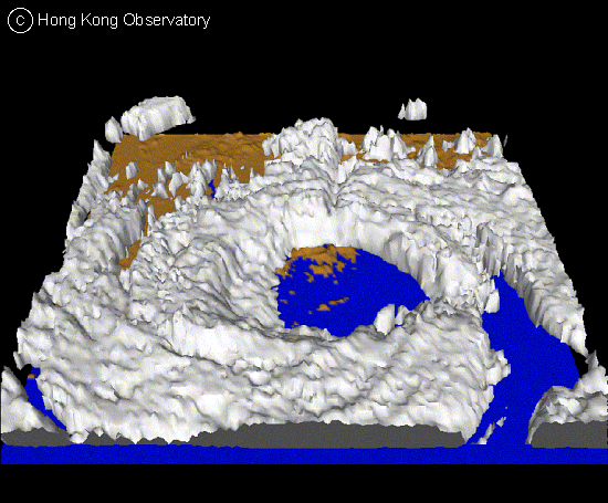 |
Three-dimensional radar image provides a vivid perspective of the structure of rain and storm. The image on the left clearly depicts the circular eye as well as the spiral rain bands of Typhoon York. Though the Hurricane Signal No. 10 was still in force at that time, the relatively calm weather in the eye of the typhoon gave Hong Kong a temporary break from rain and winds that morning. However, this lull period was replaced by violent winds and high seas as soon as the eye moved out of the territory. |
