The impact of El Niño and La Niña on Hong Kong climate
El Niño and La Niña
|
El Niño |
In winter (Dec-Feb) and spring (Mar-May), El Niño affects the atmospheric circulation over the northern part of the South China Sea, bringing generally more rainfall to the coastal region compared to the ENSO-neutral state (Figure 1a and 1b). Rainfall charts for other seasons can be found here.
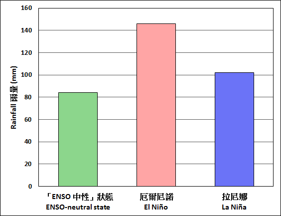
Figure 1a Winter (Dec-Feb) rainfall of Hong Kong, 1950-2015.
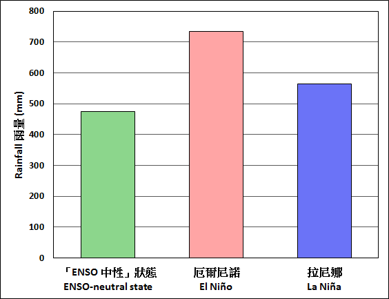
 Temperature and rainfall statistics during El Niño springs, summers, autumns & winters in recent decades
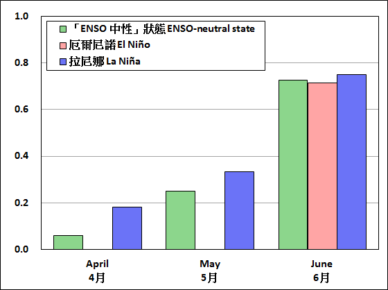
During El Niño, there are fewer tropical cyclones developed in April and May and the genesis positions are usually located further east over the western North Pacific compared to the ENSO-neutral state. Hence, tropical cyclones are unlikely to affect the territory before June (Figure 2).
La Niña |
back to top |
During La Niña, the northeast monsoon over southern China is generally stronger in autumn (Sep-Nov) and winter (Dec-Feb), bringing lower temperature in Hong Kong compared to the ENSO-neutral state (Figure 3a and 3b).
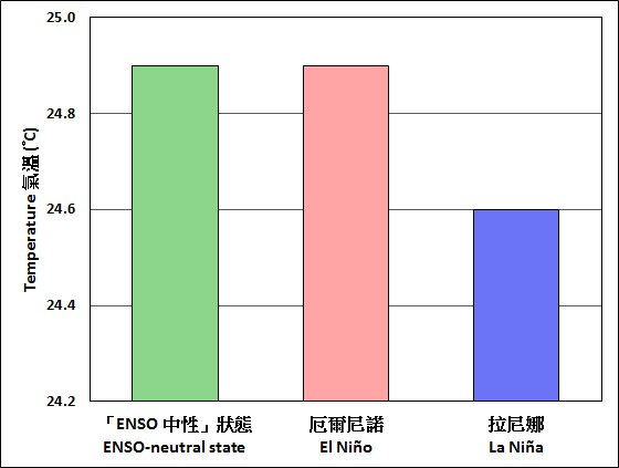
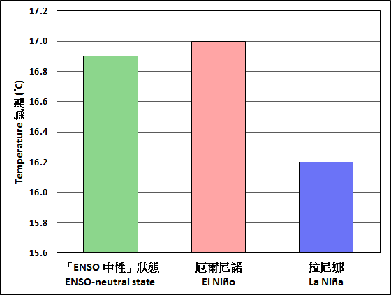
 Temperature and rainfall statistics during La Niña springs, summers, autumns & winters in recent decades
During La Niña, tropical cyclones in August-October are likely driven by an anomalous steering flow into the South China Sea and hence more tropical cyclones are likely to affect Hong Kong compared to the ENSO-neutral state (Figure 4).
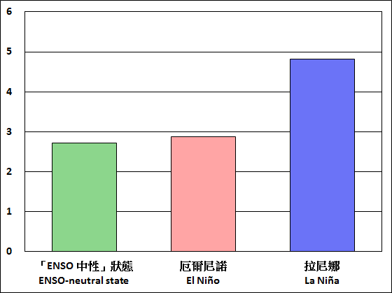
| Figure 4 | Number of tropical cyclones coming within 500 km of Hong Kong in August-October, 1961-2015. |
Note:
1. The ENSO-neutral state refers to the situation with neither an El Niño nor a La Niña in place.
